 Welcome to Changming Dong's Research Website
Southern California Bight Circulation and Forecast System (collaborating with JPL, NASA)
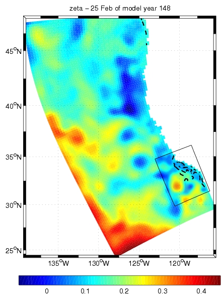
A snapshot of Sea Surface Elevation for two nested grids (20 km, 6.7km)
A nested-grid is applied to study the circulation in the Southern California Bight (SCB). The model is forced by MM5 wind,
and integrated from 1996-2003. The numerical solution is verified against Satellite remote sensing data, CalCOFI data
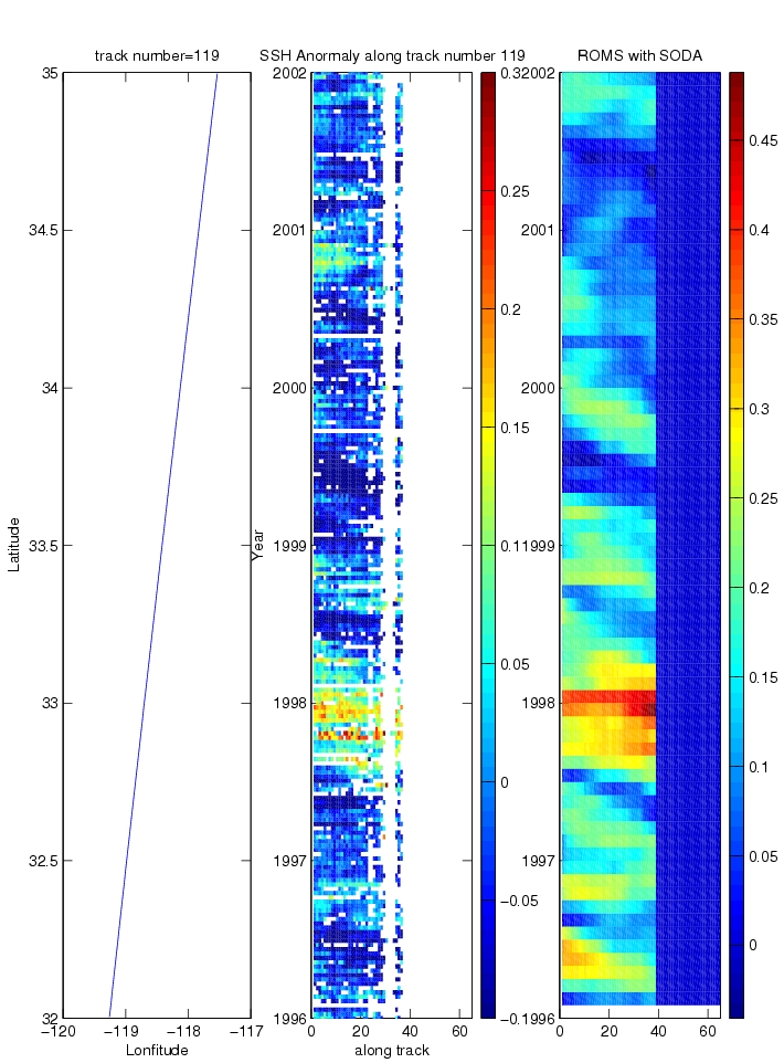
and Buoy data. The figure below shows the model catches the 97-98 ENSO signal by comparing the satellite-observed
and modeled SSH.
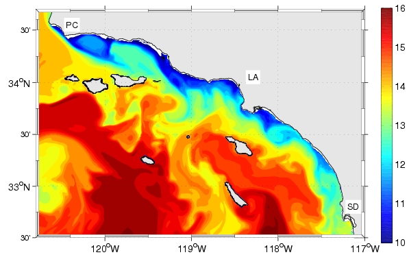
A high resolution (1km) configuration is also set up to study the circulation in SCB. The fine grid resolution model
can well simulate an upwelling event with a fine grid MM5 wind, see the figure below:
References:
- Changming Dong , Alex Hall, Mimi Hughes, and James McWilliams,2006: Impact of Wind Resolution on simulation
of a major coastal upwelling event, submitted.
- Changming Dong, Meinte Blaas, Alex Hall, Mimi Hughes
and James McWilliams, 2006: Southern California Bight Current System
forced by 1996-2003 MM5 Wind, to be submitted.
Current Researches:
- Island wakes and their environmental impact.
- High-resolution realistic simulation
- Southern California Bight Circulation and Forecast System
- Bering Sea Ice-Ecological-coupled System
- Sediment Transport
- Pollution (such as DDTs) Dispersion and Water Quality Assessment
Home Research Publications Links