|

UCLA
ROMS
U.S.
West Coast Model
Over the last five years, part of the CESR group
developed a unique simulation and modeling code. This code accounts for the many
scales that must be considered when studying broad ocean phenomena, as well
as coastal circulation systems. Called the Regional Oceanic Modeling System
(ROMS), the code is used at UCLA and at several other places.
Most of the various numerical pieces (computation kernel, realistic vertical
mixing parametrization model, robust boundary conditions adapted to long-term
integrations, variable biogeochemistry model, sediment model and Lagrangian
capability) were fit together in ROMS. We are now in a position to be able to study any regional coastal system and how it and global systems
influence each other. We are running ROMS simulations on NCSA's supercomputers,
using several hundred thousand hours of computation time each year. [UCLA ROMS group photo includes, back row: Xavier Capet, Alexander Shchepetkin, Hartmut Frenzel, Keith Stolzenbach, and Olaf Haupt; front row: Patrick Marchesiello, James McWilliams, and Nicolas Gruber.]
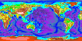
The U.S. West Coast (USWC) Model
Our initial goal has been to create an accurate
model of the North American West Coast (NAWC) regional system and to perform
realistic long-term integrations of the California Current System (CCS).
Solutions in statistical quasi-equilibrium have been obtained and analyzed
to unravel the intricate dynamics of the CCS. Similarly, a description
of the CCS ecosystem quasi-equilibrium is underway.
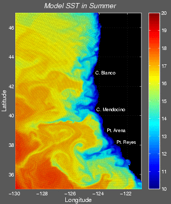
Toward the Smaller Scales : Grids Embedded into the USWC
Domain
To cope simultaneously with phenomena that
involve time and length scales with different orders of magnitude (rapid air temperature
and wind changes versus carbon dioxide levels or slow salinity variations
in the water; local circulation patterns influenced by localized winds,
storms, and coastline irregularities versus large scale circulation strongly
tied to broad atmospheric weather systems), we have chosen an approach
based on the nesting of grids with increasingly high resolution. These nested
grids work much like Adaptive Mesh Refinement techniques. A simulation starts
with the coarsest resolution grid (the parent grid) that measures a mesoscale
phenomena. Finer resolution "child" grids are then advanced by one step with
boundary conditions provided an uptodate parent solution. This goes
on as long as child grids exist. The parent grid is then modified using the
information obtained from the child grids, to create a more accurate model
that measures both large- and small-scale events over time. So far, we have
run simulations that use as many as three grid levels off the Central California
Coast and four grid levels off Southern California (with a finest grid measuring
at 500-meter intervals in the Santa Monica Bay). The high resolution
solutions obtained on the highest grid levels allow us to develop coastal
engeneering and water quality applications.
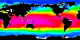
Toward the Larger Scales : Pacific Simulations
In the same spirit of looking at interactions
between different time and length scale dynamics, we began generating simulations
of the circulation (and soon ecosystems and geochemistry) for the entire Pacific
basin and then scaling down those simulations to examine conditions specific
to the NAWC. This work is aimed at a better understanding of large-scale
low frequency climate fluctuations (e.g., the periodic warming of
the sea surface temperature in the tropical Pacific El Niño Southern
Oscillation, also the lower frequency signals of the Pacific Decadal Oscillation)
affect regional currents and ecosystems.
|