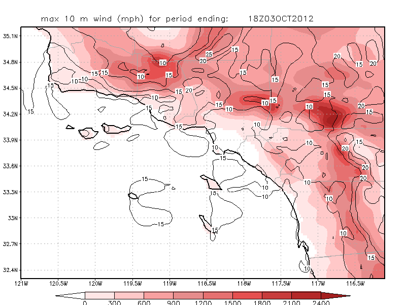
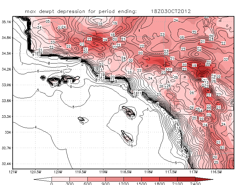
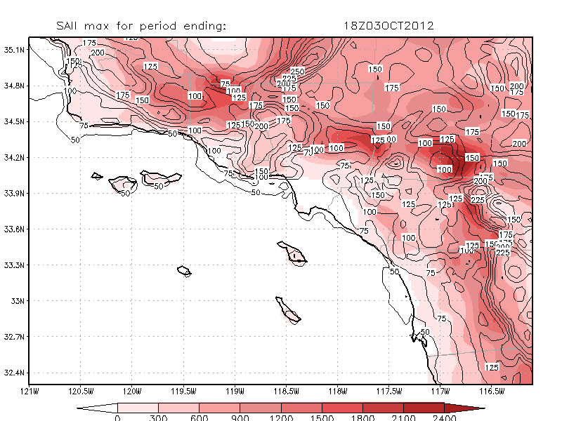
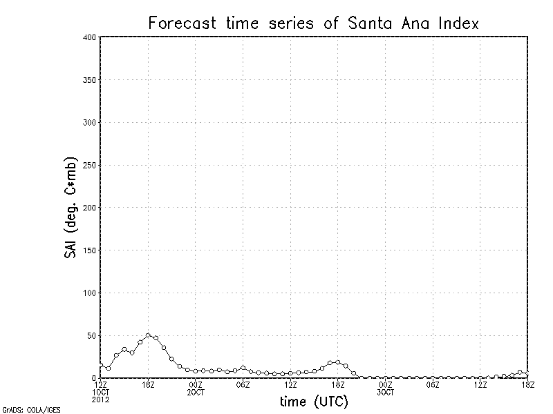
54 hour simulation using the NCAR/Penn State Mesoscale Model version 5 (MM5), subversion 3.7.3, commencing at 4 AM PST (5 AM PDT)
on the date shown in the upper
left corner of the forecast plots. Most of the pictures below show the 3 PM PST (4 PM PDT)
forecasts for Days 1 and 2. Clicking on most pictures generate animations (or at least larger sized images).
If older images appear here, you may need to reload/refresh this page
The LA area WRF run is here. This run usually finishes by noon PST.
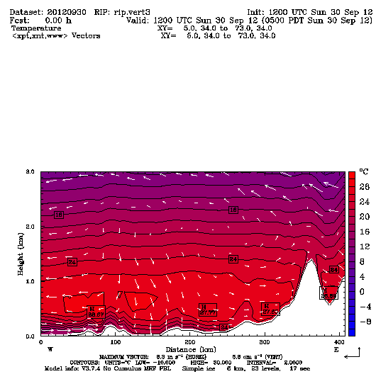
Cross-section "A": West to east from the Channel Islands past the Banning area, showing winds and temperatures (in Celsius) at 3 PM PST (4 PM PDT) on Day 2 over the
lowest 3 km. Clicking on image will spawn hourly animation in a new window.
Cross-section "B": As above, but southwest-to-northeast crossing San Nicolas Is to near Mojave.
Cross-sections "A" and "B" intersect near Pt. Dume. Clicking on image will spawn hourly animation in a new window.
Cross-section "C": Northwest to southeast across the Tehachapi Mtns to the San Bernardinos. Shown is a clear air turbulence index along with winds.
Clicking on image will spawn hourly a
nimation in a new window.
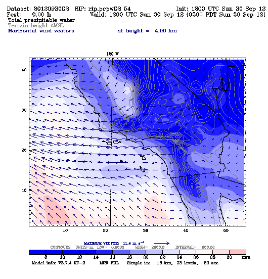
Precipitable water and 4 km winds for Domains 2 and 3
Precipitable water (in millimeters) and 4 km winds
at 3 OM PST (4 PM PDT) for Day 2.
Clicking on images will spawn hourly animations in new windows.
Domain 2
Domain 3
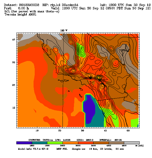
Lifting condensation level (LCL) for Domain 2
Lifting condensation level (in meters)
at 3 PM PST (4 PM PDT) on Day 2.
Clicking on image will spawn hourly animation in a new window.
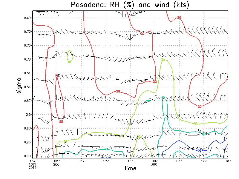
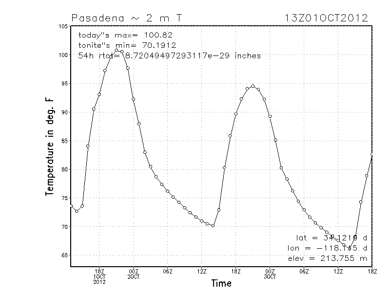
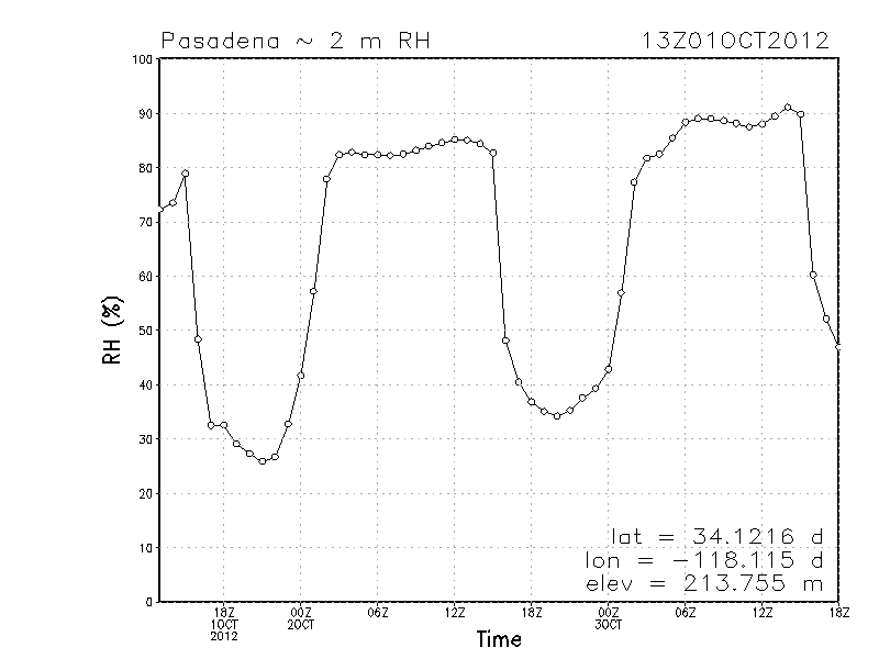
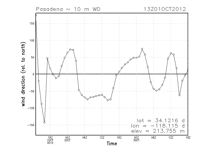
Plots for Pasadena
Plots spawn new windows
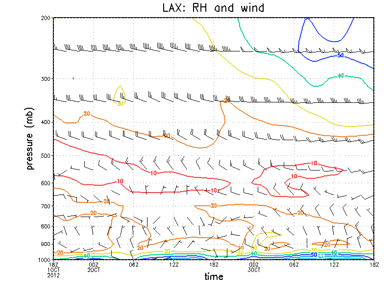
Time-height plots for temperature, RH and wind (below about 600 mb only)
Time series of 2 m temperature (F), RH (%), wind speed (kts) and wind direction (degrees CW from N)